
Travels & Tours... visit

IV - Dakhla Sightseeing
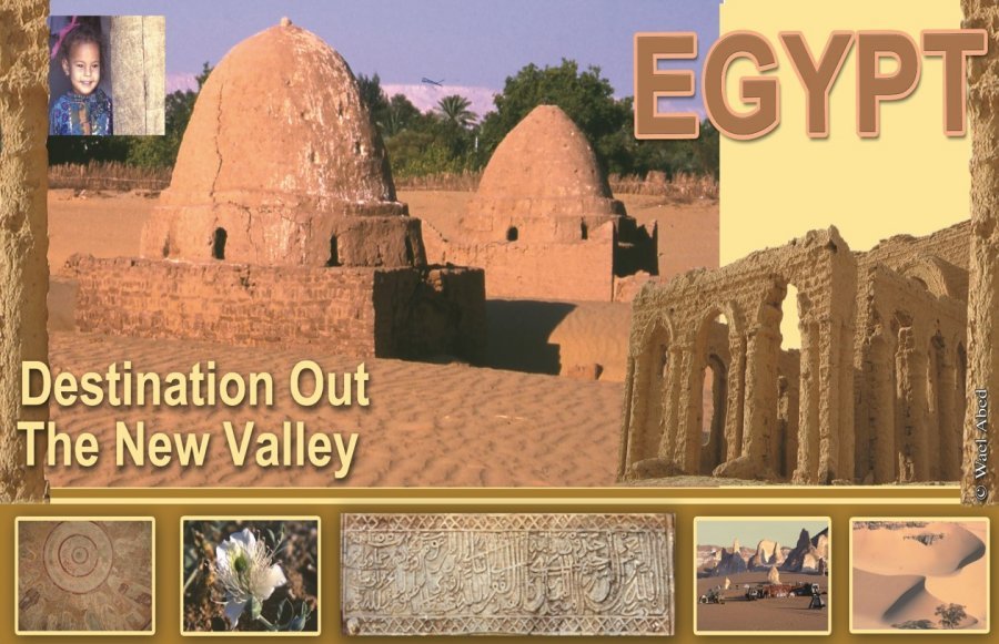
IV - Dakhla Sightseeing Details
I - Tineida & Ain Birbiya
The main road leading into Dakhla Oasis is the Darb el-Ghubari, the ‘Dust Track’, which passes from east to west through the oasis and originates in Kharga. The first point of civilization on the eastern edge of the Dakhla depression is Tineida, a village which is said to have its origins in ancient Egyptian times. Today the area is surrounded by cultivated fields which no doubt cover many remains of ancient structures.
Around 135km from Kharga, before reaching Tineida, there are rocks on the south side of the road covered with ancient carvings of giraffes, camels and men on horses. The inscriptions on the northern side of the soft sandstone rocks are well-preserved, archaeologists suggest that some may predate the Pharaonic Period,
On the east side of Tineida village, a Muslim cemetery contains several large domed sheikh’s tombs as well as many unusual painted mud grave-stones in the style of tiny houses.
Ain Birbiya
One of the most important sites in the Tineida area is a Temple of Amun-Nakht and his consort Hathor at Ain Birbiya, between the villages of Tineida and Ezbet Bashendi.
The structure of the sandstone temple is fragile and so this is the first Egyptian temple to be excavated from the top downwards, a technique that enables the archaeologists to examine the construction of the masonry.
The desert has preserved the decoration well and many reliefs so far uncovered have provided scholars with valuable information about the obscure deity who was known as ‘Amun the Mighty One, Lord of the Desert’. He is a previously unknown god named Amun-Nakht who had many attributes similar to Horus and the similar titles suggest that he was probably a local aspect of the hawk-headed god. Inscriptions claim that Amun-Nakht twice visited Dakhla in order to defeat his enemies and the excavators at Ain Birbiya have seen images of the god portrayed as an aggressive deity with outstretched wings and a spear. Like other aggressive gods Amun-Nakht was most likely also perceived by the local inhabitants as a protector from the evils of the desert, as Seth was at Hibis Temple. His consort appears to have been Hathor, also the consort of Horus.
Historical Background : The temple at Ain Birbiya is thought to date from the reign of Augustus Caesar, who constructed the gateway into the enclosure, and probably also the Emperor Hadrian. The layout of the temple apparently is fairly standard with two gateways and a processional way.
II - Ezbet Bashendi
Location: The village of Bashendi lies 4km from Tineida, to the north of the main road.
Name Origin :The inhabitants claim that the origin of the name of their village is derived from a medieval Indian prince, Pasha Hindi, who settled there and is the ancestor of most of the villagers. This is a romantic story and although Pasha Hindi’s domed tomb (built over a Roman tomb) can be found in the village, the modern name is more likely to be derived from ancient Egyptian.
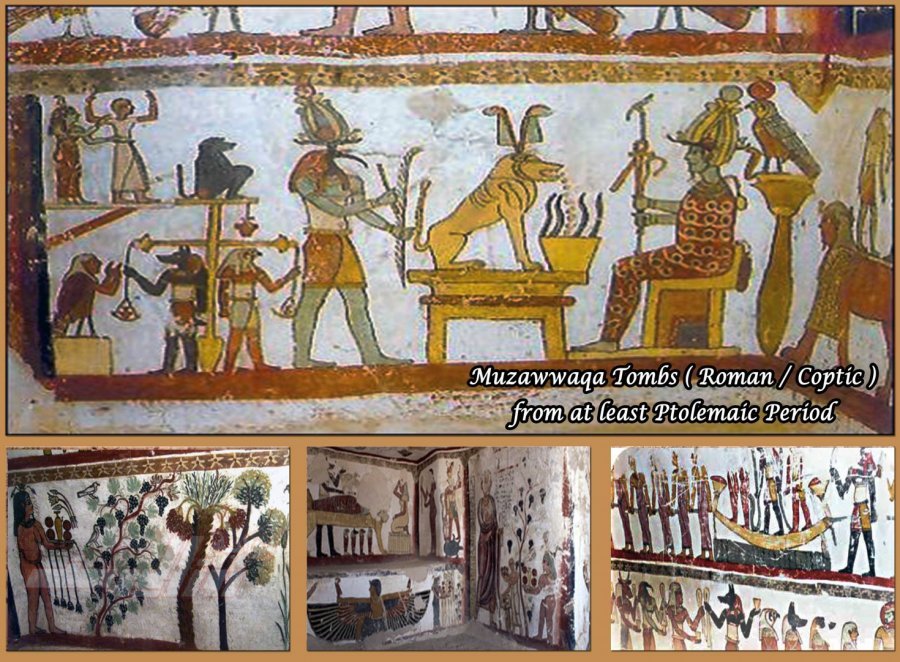
Historical Background: Even the houses are considered to be of pharaonic design and are said to sit on top of pharaonic remains. The village was probably first inhabited during the Christian era and Roman tombs lie under the foundations of many of the existing houses. Some of these are accessible, including the tomb of Kitines (2nd century AD) which consists of six chambers with relief decoration in a mixture of Egyptian and Roman styles. There is also said to be a New Kingdom Temple of Mut in the vicinity.
To the south-west of Bashendi, at Ain Tirghi is a cemetery thought to date from the Second Intermediate Period, though most burials appear to date to the Late and Roman Periods. Some of the tombs contain as many as 40 burials.
DAKHLA
Balat village
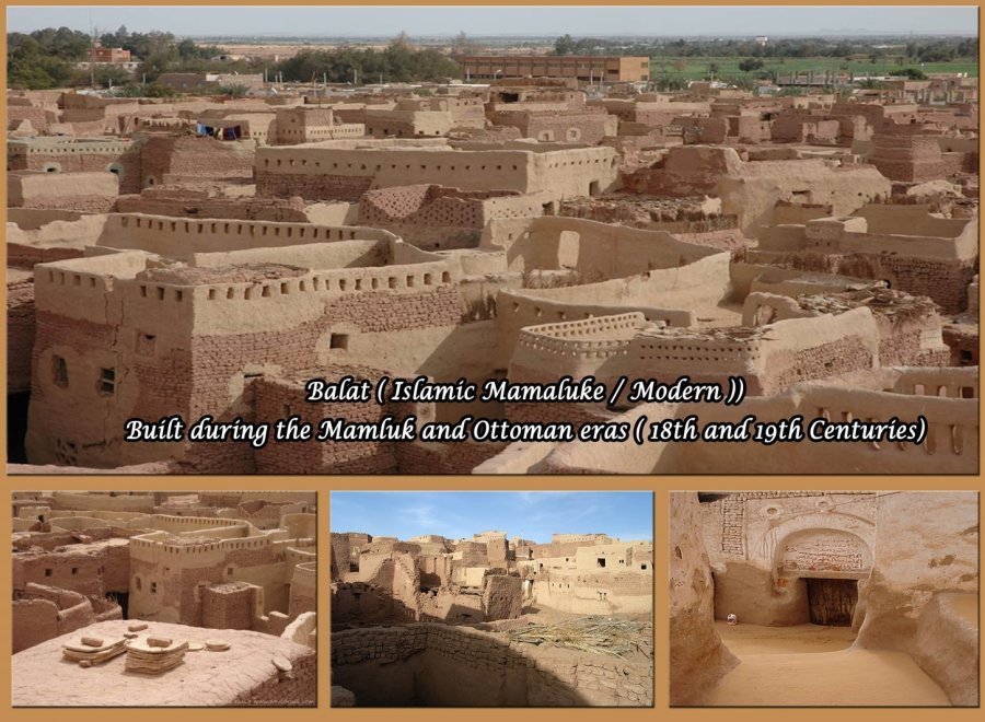
Balat has its moments. Many of its quarters appear just as they must have done centuries ago. Walls and street are well-kept, colours often bright, doors worn down yet more beautiful than any new door can be. Many walls are illustrated, telling passers-by about the owner's trip to Mecca for the pilgrimage.
Balat has unlike several other villages of Dakhla a living old town, and what is even better, is that the mosque has not yet been replaced with a Cairo-designed pre-fab mosque. Look inside, and you will see delightfully thick columns (as they are made from clay and brick they have not the same carrying capacity as stone or cement), and only smooth curves; never a straight line.
III - Balat, ‘Ain Asil & Qila el-Dab’a
- Balat
The modern village of Balat, around 9km west of Tineida, has spread beyond the older fortified town. Built during the Mamaluke and Turkish eras, the Islamic town is perched on a mound and is little changed since Medieval times. Inside the walls of this once busy town, picturesque winding lanes roofed with palm fronds shelter dark ornately carved doorways of houses typical of the Islamic architecture in the oases during this period.
Now Balat is beginning to reveal its secrets of an even earlier history, for nearby at Qila el-Dab’a is an Old Kingdom necropolis and an associated settlement from the same period at Ain Asil. These areas are currently being excavated.
- Ain Asil
The settlement of Ain Asil (Spring of the Source) is 3km east of Balat and 8km north-west of Tineida, at the junction where the ancient Darb el-Tawil joins other routes through the oasis. T
his has proved to be one of the best-preserved examples in Egypt of an Old Kingdom town, with important remains of a governor’s palace, houses and workshops.
The site at Ain Asil, originally a small fortified enclosure, later encompassed a rectangular area of 33 hectares, split into two separate parts. The earliest is the fortress area to the north, with a mudbrick settlement extending to the south and east of this. An administrative centre for Dakhla during the reigns of Pepi I and Pepi II, most of the town appears to have been destroyed by fire at the end of the Old Kingdom and abandoned for a time. A rare discovery of inscribed clay tablets dating to Dynasty VI provides the earliest evidence that Dakhla Oasis was linked to the Nile Valley during this time. The tablets contain names of governors of the oasis and their households in hieratic script as well as lists of distribution of goods and food supplies to the palace, valuable information which in other areas of Egypt were usually written on papyrus.
Although a fire destroyed much of the early town and part of the fortress-like structure, it was rebuilt during the First Intermediate Period to include the enclosure wall and a canal and a great deal of restoration seems to have been undertaken. The destruction by fire has allowed archaeologists to gain much information about the Old Kingdom structures. It seems to have been abandoned before the Ptolemaic Period and so far no Roman remains have been found at the site.
- Qila el-Dab’a
Qila el-Dab’a, the necropolis associated with the Old Kingdom settlement at Ain Asil, is located about 1.5km to the west of the ancient town.
The mastabas were constructed in steps from mud bricks and dressed with slabs of limestone. When found, the tombs were in various stages of ruin, but basically followed the plan of a large brick enclosure surrounding a courtyard in which the mastaba stood. The tombs had niched façades like others of the Old Kingdom and a funerary Stella at the entrance identified the occupant. A stela of the governor Khentikau-Pepi can be seen in the Kharga Heritage Museum. Inside the tombs there are a number of rooms, antechambers and burial chambers with barrel-vaulted roofs. The first to be identified was the tomb of the governor Medunefer who served during the reign of Pepi II and which contained funerary goods including gold jewellery. In the mastaba of Khentikau-Pepi, over 100 pottery vessels were found in fragments beneath the fallen masonry in the underground chambers. Other governors who built mastabas at Qila el-Dab’a include Khentika, also from the reign of Pepi II whose painted subterranean chambers have been restored, and Ima-Pepi, whose later tomb shows an improvement in construction techniques.
IV - Ismant el-Kharab
Location: The ancient town of Kellis, situated 2km to the east of the modern village of Ismant (or Smint), is now known as Ismant el-Kharab, meaning ‘Ismant the ruined’. The mud brick tombs, temples and settlement remains of Kellis, can be seen from the road at a point about 20km east of Mut.
Historical background : Inhabited for seven centuries, Kellis was once a thriving and well-populated market town and the past two decades of excavation has uncovered a wealth of Roman and Coptic remains, including houses, churches, wells, a bath-house, storage buildings, aqueducts and a cemetery of free-standing tombs. This is another site where a deep covering of sand has served to preserve many of the structures up to a height of 2 to 4m and its importance is seen in terms of what it has revealed of the emergence of Christianity in Roman Egypt. The settlement is still being studied by several teams and has been found to contain many interesting structures, mostly from the Roman and Christian eras as well as important cultural objects such as bedsprings, pottery and basketry. Thousands of literary texts and religious writings in Greek and Coptic on papyrus fragments have been discovered in the domestic site which indicate a great diversity of beliefs. Gnostic papyri relate to the presence of a Manichaean community there by AD 300, offering a unique version of Christianity as taught by the followers of the prophet Mani, alongside the more orthodox Catholic faith which had begun to spread throughout Egypt. Three mud brick churches have been found at Kellis, one of them has been securely dated to the 4th century AD by a hoard of coins found there and is said to be the oldest Christian church in Egypt.
A large mud brick walled area to the south-west of the settlement encloses two small stone temples, a number of mud brick shrines and various storage buildings, dating from the 1st century AD and probably the Emperor Hadrian. The complex has been under investigation since 1991 and the most recent excavations have revealed Ptolemaic ceramics, perhaps giving the site an even earlier date. The largest temple to the east contains three parallel sanctuaries. Outer walls were decorated with engaged columns but reliefs survive only in small fragments, as this and the smaller temple were quarried for their stone. By contrast the larger of the mud brick shrines (Shrine I), which may have functioned as a mammisi, has much of its original painted decoration intact.
The two temples and the shrines were dedicated to the supreme god Tutu and the goddesses Tapshay (Tapsais), his consort and Neith, his mother . Tutu (Greek Tithoes), an ancient and obscure god venerated mostly in Graeco-Roman times, held the title ‘Master of Demons’. He was also called ‘he who keeps enemies at a distance’ and was believed to provide protection from hostile forces and evil demons, specifically the genii or destructive forces of Sekhmet. Tutu was depicted in the form of a walking lion or a sphinx, sometimes with a human head, the wings of a bird and the tail of a snake. His monuments at Kellis are the only known remains of a cult centre for this god, though he also appears in the Coptos region in the Nile Valley. Other deities depicted in Shrine I at Kellis include Amun-Re, Mut, Khons, Thoth and Nehmetaway, who are also venerated at the Dakhla Temple of Deir el-Hagar and possibly at Amheida. In other areas of decoration in Shrine I, groups of deities include Osiris ‘Lord of the Oasis’, Harsiese, Isis and Nephthys as well as Amun-Nakht (also seen at Ain Birbiya), Khnum, Isis and Hathor – it is in fact an inventory of all the main deities represented in Dakhla Oasis.
.Kellis seems to have been occupied from the Ptolemaic Period and abandoned sometime around the end the 4th century AD during the Roman-Byzantine Period. Evidence has been found to suggest that until then it was an area of heavy trading with many people coming and going, and perhaps like other settlements in the oases, a place of banishment. .
V- Mut el-Kharab
The modern city of Mut is the main centre of population in Dakhla Oasis today. Once a fortified town, the old Islamic quarter is still inhabited and though its painted houses and dark winding alleyways are now crumbling into ruins, it is characteristic of the Medieval settlements seen in other parts of the oases. The town’s defense was to bolt its heavy gates at night, closing off the streets to any invaders.
Mut el-Kharab (Mut the Ruined) is the ancient town probably named after the goddess Mut, consort of Amun. This area lies to the south-west of the modern city and though its ruins represent many periods of Egyptian history, it is still mostly buried beneath the desert sands. Two stelae acquired in 1894, dated to the Dynasty XXII reigns of Shoshenq I and III or IV and now in the Ashmolean Museum in Oxford, refer to an oracle of Seth. They are thought be from the temple site at Mut el-Kharab and highlighted the importance of Mut and the cult of Seth in Dakhla during the later periods of Egyptian history.
Historical background : The temple was dedicated to the god Seth and although very poorly preserved, decorated blocks have been found here which contain fragmentary cartouches of Tuthmose III, Horemheb, Psusennes I, Psamtek I and some Ptolemaic rulers. Seth was a major deity in Dakhla Oasis from the Third Intermediate Period onwards and especially during the Roman Period. The 2005 season of excavations have provided evidence to date the extant remains of the temple to the early Roman Period, but these are overlaying earlier deposits from the Third Intermediate Period and perhaps the New Kingdom. No decorated blocks have been uncovered from the Roman remains as it would seem that the Roman rulers re-used blocks from the earlier temples, ranging in date from Dynasty XVIII to the Ptolemaic Period. These blocks contain references to Seth, Amun and various priests. A pit within a recently excavated room in the temple complex has revealed a collection of gypsum and ceramic moulds for the production of inlays for a large image of a falcon-headed winged god, similar to the portrayal of the winged Seth in Hibis Temple, and to the local deity Amun-Nakht found at Ain Birbiya.
Al-Qasr
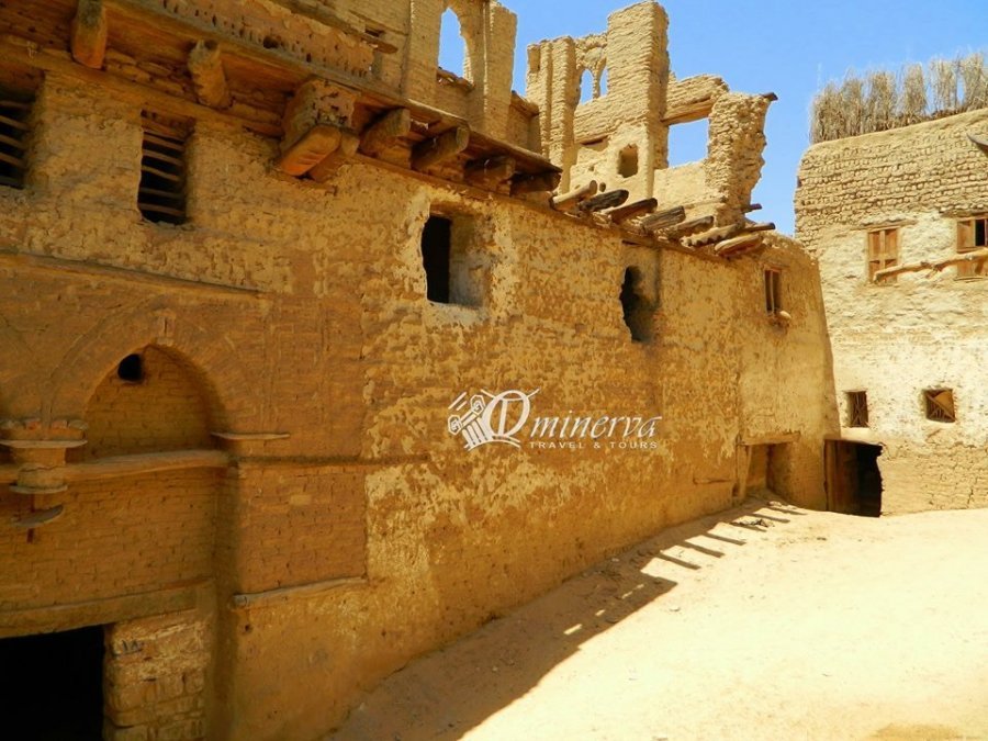
For many visitors to Dakhla, Al-Qasr is the most memorable part. With an old town with many streets in excellent condition, it offers the best illustration of the oasis' past.
Although modern "progress" has been gentle on Al-Qasr, the old quarters are almost completely abandoned. It is really sad, old Al-Qasr is beautiful and offers smart protection against summer heat, while the modern houses needs electric air-conditioning to stay pleasant.
VI- Qasr Dakhla
Location: Qasr Dakhla, situated to the north-west of Mut, is one of the fortified Medieval Islamic towns often seen in the oases and said to be the oldest continuously inhabited and the best preserved settlement of its type in Dakhla. It rests on the Sioh Ridge, nestled beneath the pink limestone escarpment which marks the northern limit of the oasis.
Historical Background : The Islamic town, el-Qasr (meaning ‘the Fortress’) was probably founded around the end of the 12th century AD by the Ayyubids, over the remains of an earlier Roman Period settlement. During this time the fortified town is thought to have been the capital of the oasis, constructed in a defensive position against marauding invaders from the south and west.
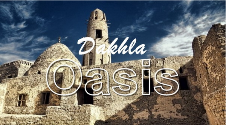
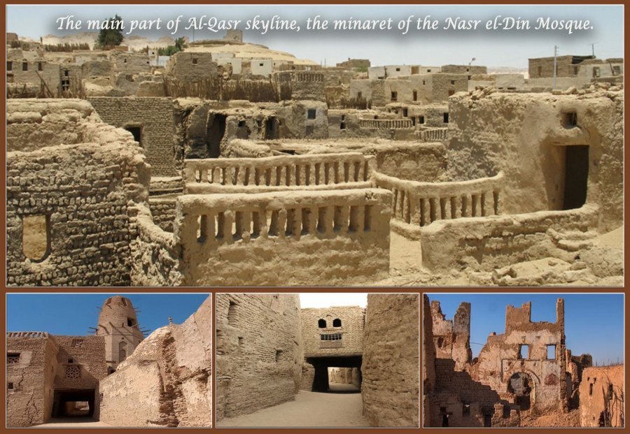
The narrow covered streets have changed little since Medieval times and a three-story mud brick minaret rising 21m above the mosque of Nasr el-Din, erected during the Ayyubid Period, is one of the landmarks of the town. The minaret is the only part of the original mosque from the 11th or 12th century to survive,
The Friday Mosque of Al-Qasr
The 12th century Nasr el-Din Mosque is clearly the most known building of Dakhla, but it is most impressive when seen from a distance, when the town lies clearly beneath it, and with the pink mountains in the behind.
The 21 metre high minaret is in fine condition, even if much of two wooden terraces have been dismantled after the mosque lost its functions. It's pepperpot finial is typical of Ayyubid architecture.
DAKHLA
The madrasa of Al-Qasr
The madrasa dates back to the 10th century, and predates the mosques of Al-Qasr. The main congregation hall, which served as both lecture room and prayer hall is really nice, with painted liwans (see top picture) which were used as libraries.
A madrasa was a mixture of a high school and a university, an all subjects were related to Islam, with perhaps law as the most important.
DAKHLA
Street scenes of old Al-Qasr
As the only old town of Dakhla, it is possible for a first time visitor to get lost here. It really does take some time to cover the area.
The old town holds many fine and creative details and shapes. Many of the doorways are centuries old, some dating even back to Mamluk times.
Walking the area is best done together with one of the guides that meet up at the small space in front of the new white mosque. Not that a person speaking only his native tongue will tell you stories, but he knows which streets hold the good stuff, and most important: He carries a key to open closed doors.
DAKHLA
The museum of Al-Qasr
The Ethnographic Museum of Al-Qasr is a private initiative, aiming at presenting how life was on the inside of the house walls before locals left the old quarters. You will see exhibitions of the rooms of a house, work places and several photos.
DAKHLA
Beautiful little Qalamoun
Qalamoun is a quick ride out of Mut and much of its old quarters are still inhabited, and well-kept. It is clearly one of Dakhla's nicest settlements, and the setting doesn't make it any worse. Coming to Qalamoun you will pass luscious lakes (keep repeating to yourself: This is in the middle of Sahara) while the the hilltop village grows in front of you. Upon leaving the village, the village is immediately replaced by golden sand dunes.
I think that Qalamoun is the closest I have come to the romantic image of a desert village.
DAKHLA
Ottoman tombs and more near Qalamoun
Due to long time neglect, there is less and less to see of the Ottoman tombs near Qalamoun. Qalamoun was the village of Mamluk and Ottoman officials, therefore this distinct graveyard.
Another interesting place near Qalamoun is the artificial lake, which is quite beautiful. It is easy to miss, not being right next to the road.
Mut
|
Mut represents the original settlement of Dakhla. Today it is the largest and most modern settlement in the oasis. Not without charm it clearly not what visitors come far away to see. Mut's main attraction is the hotels and the basic but friendly restaurants. |
The artificial lake northwest of Mut is both called "Man-made Lake" and "Fish Pond".
It is clearly worth the stop for anyone interested in bird-watching. Many of the birds here migrate from Europe, and the Rough Guide travel book series list avocet, stilt and coot as the ones to first look out
|
The ancient city Rashda village Amheida, on the western edge of Dakhla Oasis, is a vast archaeological site, reached via the loop road running from Mut to el-Qasr. The area which extends for 5km to the west of the road, is thought to be the site of the ancient Roman town of Trimethis, according to literary sources, although the surrounding landscape indicates substantial occupation pre-dating the Roman Period. As with many sites in the oasis there is a scattering of prehistoric material as well as an Old Kingdom settlement and evidence of Pharaonic and Ptolemaic remains. But it is for its Roman ruins that Amheida is best known at present, in an area of 100 hectares occupied from the 1st to the 4th centuries AD and constituting one of the largest Roman settlements at Dakhla. The archaeological site is divided into four areas. Area 1 is mostly a domestic and industrial site, Area 2 has elaborately painted vaulted and domed structures and Area 3 has an impressive ‘pyramidal’ structure, thought to date to the Roman period, that is surrounded by vaulted tombs. A further Area 4 has most recently investgated. Budkhulu village Old Budkhulu is falling apart, and something valuable will be lost forever. Bashendi village
|
Gallery
Lastest News
-

Medical tourism in New Valley
Shanda Lodge
-

Location
Shanda Lodge
-

Easter trip
Shanda Lodge
-

Farfra Sightseeing
Shanda Lodge
-

SHanda I T B
Shanda Lodge